 R-3430 - Malcolm Boulevard/Connelly Springs Road
R-3430 - Malcolm Boulevard/Connelly Springs Road
IMPROVEMENTS TO MALCOLM BOULEVARD / CONNELLY SPRINGS ROAD FROM U.S. 70 TO SOUTHWEST BOULEVARD IN BURKE AND CALDWELL COUNTIES
Vicinity Map:
Project Overview:
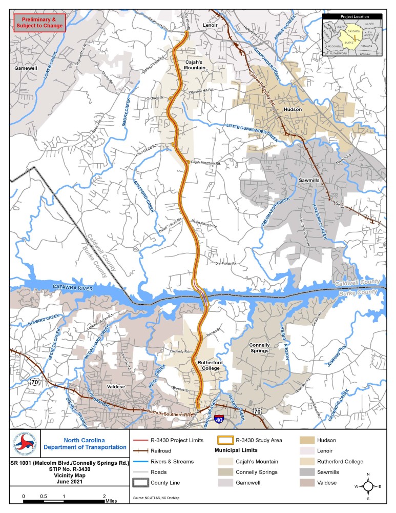
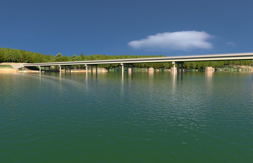
The N.C. Department of Transportation proposes improvements to about ten miles of Malcolm Boulevard/Connelly Springs Road (S.R. 1001) from U.S. in Burke County to Southwest Boulevard (S.R. 1933) in Caldwell County. Examples of roadway modernization include: intersection improvements/alternative intersections, access modifications, and roadway improvements that add multi-modal elements (e.g., accommodate more than motorized vehicles). Modernization improvements do not expand the capacity of a roadway (e.g., the number of through travel lanes). The modernization improvements would enhance traffic flow and improve safety along the project corridor. A key project component is replacing Castle Bridge over the Catawba River.
The project is divided into three sections:
R-3430A: U.S. 70 to Catawba River
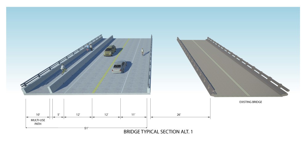
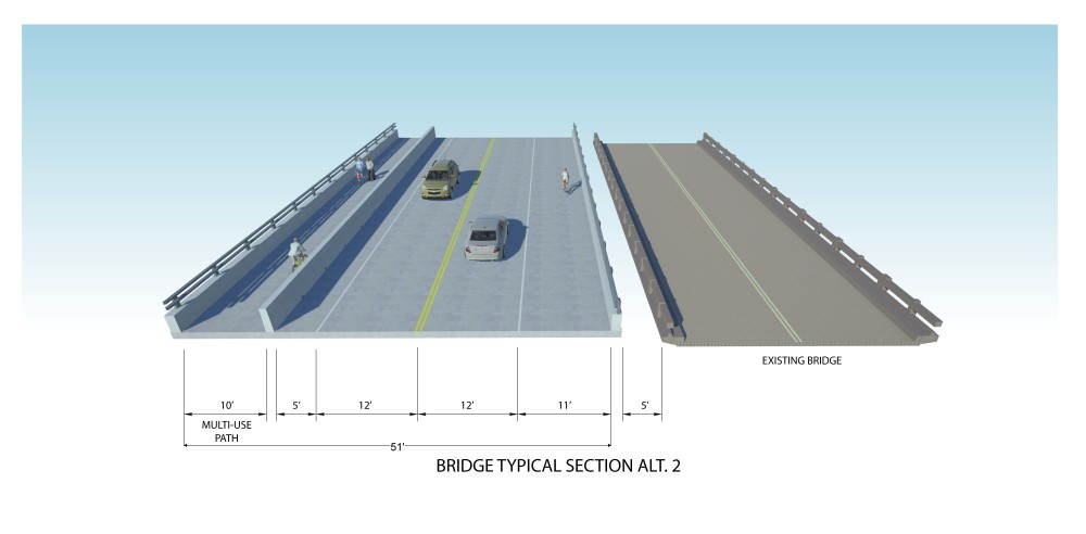
R-3430B: Replace the Castle Bridge over Catawba River
R-3430C: Catawba River to Southwest Boulevard
Section B is the only portion of the project that is funded and is scheduled for Right of Way acquisition in Spring 2022 and Construction in Summer 2023. Section A is unfunded, and Section C is scheduled for Right of Way in fiscal year (FY) 2026 and Construction in FY 2029.
The handout provides information about the project.
Project History:
The project, with varying sections, has a long history. When the project was federally funded, an Environmental Assessment was completed for improvements from Dry Ponds Road to Southwest Boulevard in 2009. The public hearing, completion of the final environmental document, and final design preparation were suspended as the project was removed from the State Transportation Improvement Program. The project restarted in Spring 2018 with new project limits.
Project Highlights:
Castle Bridge Replacement (R-3430B)
NCDOT studied many options in detail for the bridge replacement, including two alternatives that would replace the bridge on new location, and one alternative that would widen the existing structure using phased construction. None of the bridge options NCDOT is considering would require an off-site detour or temporary closure of the existing bridge. All traffic would be maintained on the existing structure during construction with all three options.
- Alternative 1 - Replace Bridge on New Location
Alternative 1 consists of building a new parallel 51-foot wide bridge about 26 feet west of the existing bridge. Traffic would remain on the existing bridge until the completion of the new bridge, at which point the current bridge would be demolished. If a multi-lane roadway is ever needed in the future, the proposed bridge would be converted to two southbound lanes, and a separate northbound bridge would be built east of the proposed bridge under this project.
- Alternative 2 - Replace Bridge on New Location
Alternative 2 consists of building a new parallel 51-foot wide bridge about five feet west of the existing bridge. Traffic would remain on the existing bridge until the completion of the new bridge, at which point the current bridge would be demolished. If a multi-lane roadway is ever needed in the future, the proposed bridge would be widened toward the location of the current bridge.
- Alternative 3 - Widen Existing Bridge Using Phased Construction (Alternative 3 has been eliminated from alternative selection)
Alternative 3 consists of using the existing bridge foundations to build an approximately 65-foot wide bridge. The bridge would be built in phases to maintain traffic during construction. Traffic would remain on the existing bridge while a portion of the new bridge is built. Traffic would then be shifted to the new section. The existing bridge deck would be replaced and connected to the new bridge.
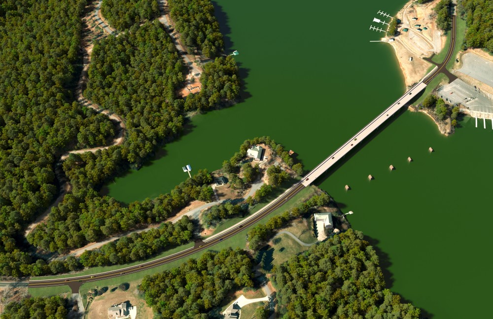
Aerial view of Section B, including the replacement of Castle Bridge.
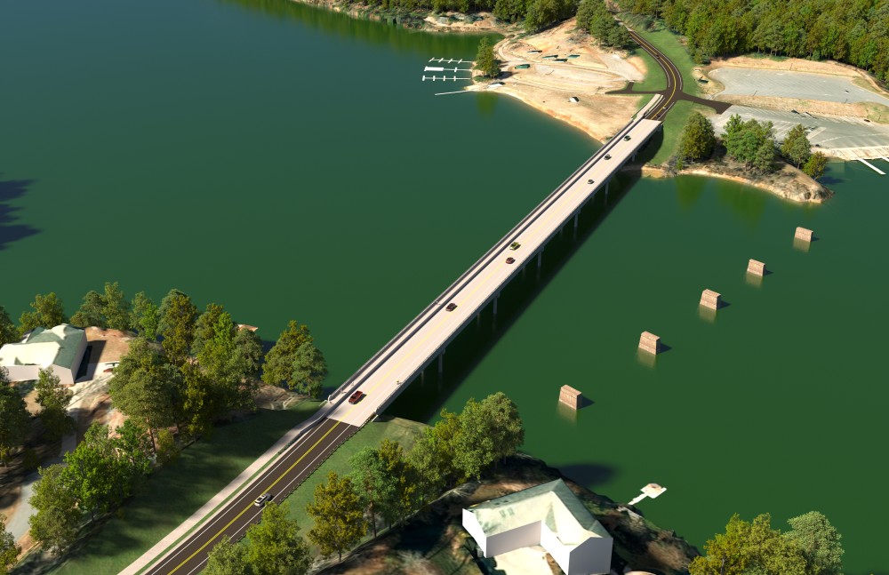
Aerial view of the potential bridge replacement.
Street view of Castle Bridge following replacement.
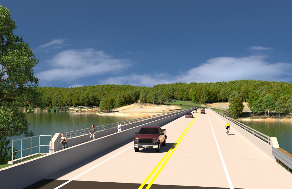
Side view of Castle Bridge following replacement.
R-3430A and R-3430C (Sections outside of the bridge replacement)
Traffic and Safety Conditions and Project Purpose and Need
Traffic forecasts and operations analysis, as well as a safety analysis revealed that future volumes are not expected to be problematic along the corridor or at intersections. Project studies concluded that a multi-lane (i.e., four-lane) improvement is not warranted for the R-3430A and R-3430C project sections.
Traffic Volumes are found here
Five-year crash data are found here
Improvement Recommendations
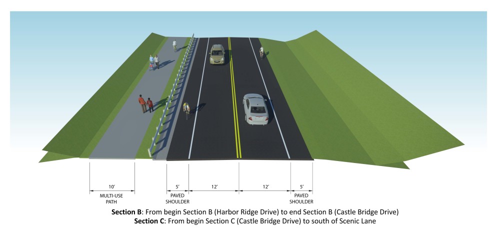
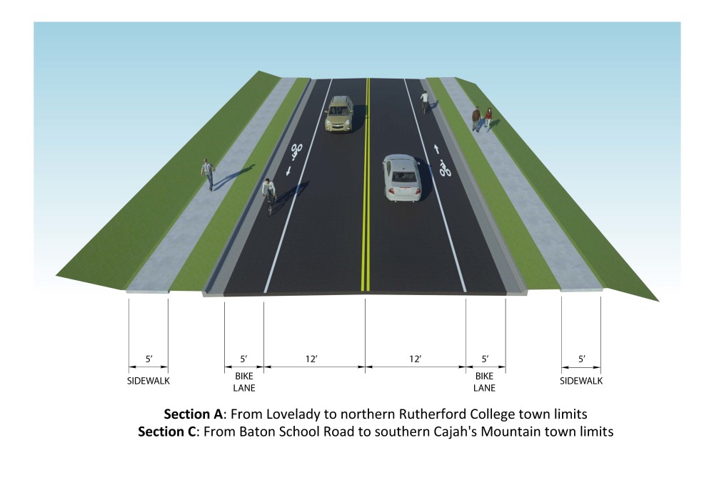
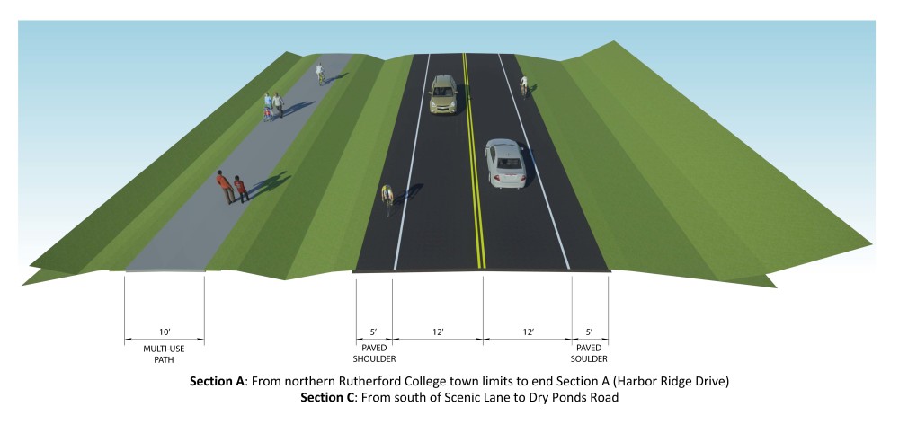
R-3430A - As shown in the Recommended Roadway Improvements figure (Roadway Improvements), proposed improvements for this section include a TWLTL from Green Street to Lovelady Road.
Three different roadway typical sections are proposed, which all include bicycle and pedestrian accommodations.
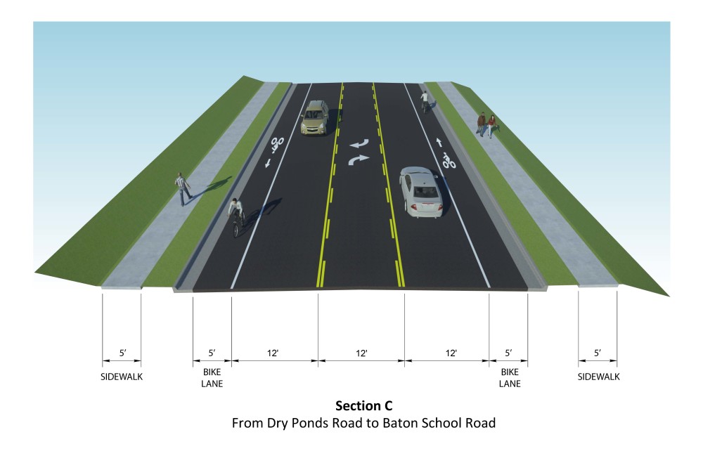
R-3430C - As shown in the Recommended Roadway Improvements figure (Roadway Improvements), proposed improvements for this section include a TWLTL from Dry Ponds Road to Baton School Road and from Cajah Mountain Road to Southwest Boulevard. Additionally, intersection improvements would include a westbound right-turn lane extension at Cajah Mountain Road on the east side, an eastbound right-turn lane extension on Union Grove Road, and an eastbound right-turn lane extension on Orchard Drive.
There are five roadway typical sections proposed for this section, all which include bicycle and pedestrian accommodations

Public Input:
Information will be provided to the public in a virtual format on this website. The public is encouraged to provide comments or share their thoughts regarding the project. The comment period for this project ended on October 15.
Project Overview Video:
Project Map:
R-3430A: A Roadway Section from Green Street to Lovelady Road
R-3430B: Bridge Replacement Alternative 1
R-3430B: Bridge Replacement Alternative 2
R-3430B: Bridge Replacement Alternative 3
R-3430C: Roadway Section from Castle Bridge Drive to Conway Drive
R-3430C: Roadway Section from Conway Drive to Oakmont Drive
R-3430C: Roadway Section from Oakmont Drive to Southwest Boulevard
A video explaining how to read a public hearing or meeting map can be viewed below. The video contains information on colors used and symbology.
Project Funding:
R-3430 is listed in the State Transportation Improvement Program and funded for $130.98 million.
Activity | Estimated Amount* |
Project Development & Design | $ 2,807,000 (prior) |
Property Acquisition | $ 38,000,000 |
| Utilities | $ 5,673,000 |
Construction Costs | $ 84,500,000 |
Total Cost | $ 130,980,000 |
* As shown in the currently adopted State Transporation Improvement Program - Subject to change
Project Timeline:
Milestone | Date* |
Public outreach | Fall 2021 |
| Environmental Document (All Sections) | Fall 2021 |
Right of Way (Section B) | Spring 2022 |
Construction (Section B) | 2024 |
* As shown in the currently adopted State Transporation Improvement Program - Subject to change
Comments:
All comments will be taken into consideration, and carry equal weight, regardless of submittal method
You may leave a comment or question below
Or
Email the comment or question to Malcolm-ConnellySprings@PublicInput.com
Or
Phone Number: (855) 925-2801 Code: 9436
The information shown on this site includes recommendations for areas where a two-way left-turn lane (TWLTL) would provide traffic flow and safety benefits and where intersection improvements are recommended.
Project Contact Information:
Elise Bielen
NCDOT Project Management Unit
Project Manager
1582 Mail Service Center
Raleigh, NC 27699-1582
Project Consultant Information:
Kim Bereis, AICP
DRMP
Project Manager
4235 South Stream Boulevard, Suite 150
Charlotte, NC 28217
Project Email Address: Malcolm-ConnellySprings@PublicInput.com
RESOURCES FOR PROPERTY OWNERS
Although the N.C. Department of Transportation works to minimize the number of homes and businesses displaced by a road project, it is inevitable, in many cases, that a certain amount of private property is needed. The following information explains right of way acquisition and answers questions about the process.
Right-of-Way Brochure Single Page Layout Folleto del Proceso de Adquisición de Bienes Raíces
Right-of-Way Frequently Asked Questions
Right of way Acquisition Process Videos