 B-6051 and U-6143: Wilkinson Blvd. in Gaston and Mecklenburg Counties
B-6051 and U-6143: Wilkinson Blvd. in Gaston and Mecklenburg Counties
B-6051- Replacement of the Bridge on Wilkinson Boulevard (U.S. 74 / U.S. 29) over the Catawba River (Lake Wylie) on the Gaston / Mecklenburg County line.
U-6143 - Improvements to the intersection of Catawba Street (N.C. 7) with Wilkinson Boulevard (U.S. 74 / U.S. 29)
Project Overview Video
Project Overview
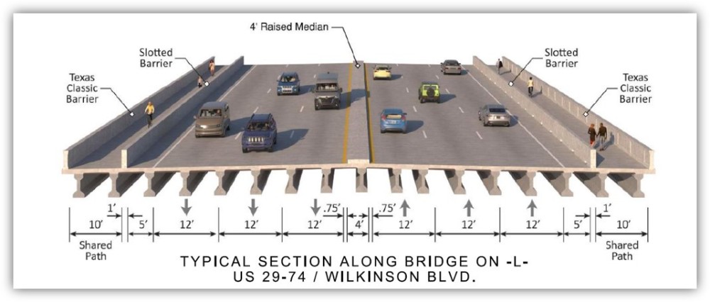
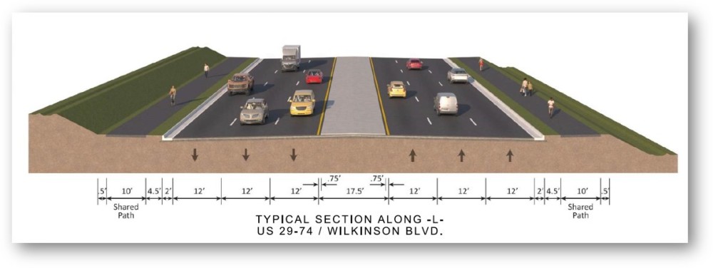
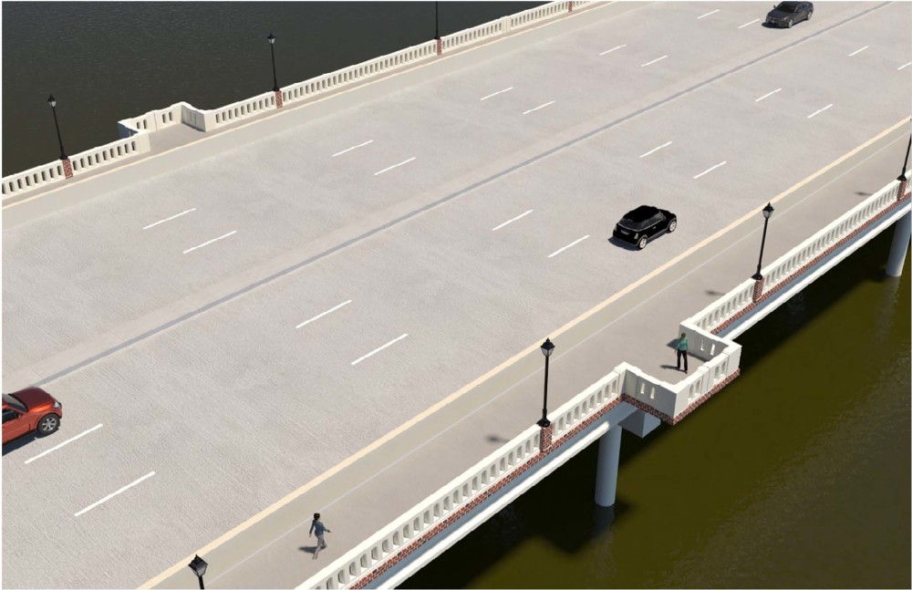
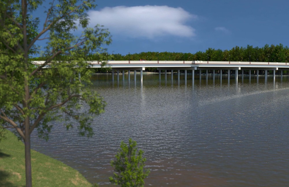
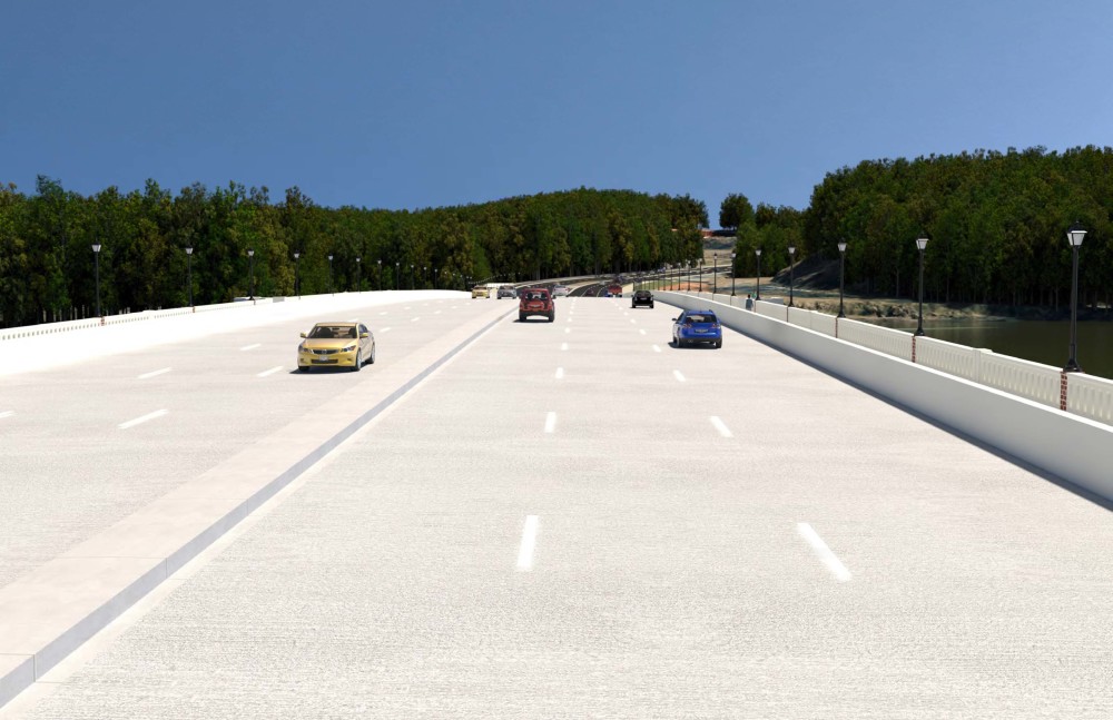
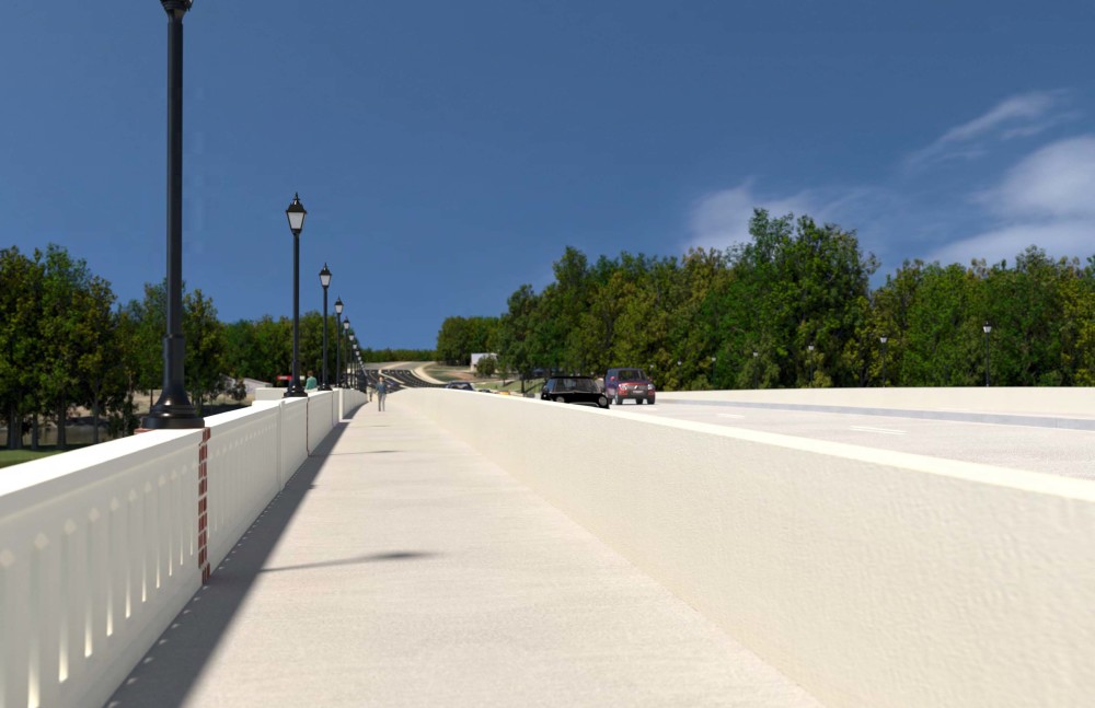
B-6051 - The N.C. Department of Transportation proposes to replace the bridge on Wilkinson Boulevard (U.S. 74/ U.S. 29) over the Catawba River (Lake Wylie) on the Gaston/Mecklenburg County Line. Wilkinson Boulevard is 6 lanes wide west of the bridge (Gaston County) and 5 lanes wide east (Mecklenburg County) which periodically causes a bottleneck, especially when I-85 traffic is detoured to U.S. 74 during emergencies. The new bridge will be 6 lanes wide to eliminate the bottleneck. The bridge will also be raised at the mid-point to allow for better navigational clearance for boating traffic.
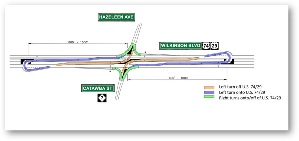
U-6143 - Includes improvements to the intersection of Catawba Street (N.C. 7) with Wilkinson Boulevard (U.S. 74/ U.S. 29). In the mornings there are backups from northbound Catawba Street onto eastbound Wilkinson Boulevard. In the afternoons, the opposite occurs: there are backups from westbound Wilkinson Boulevard for traffic turning onto southbound Catawba Street. The project will modify the intersection from a traditional intersection to a reduced conflict intersection, which is a design better suited to handle the volume of traffic moving through the intersection.
Project Highlights
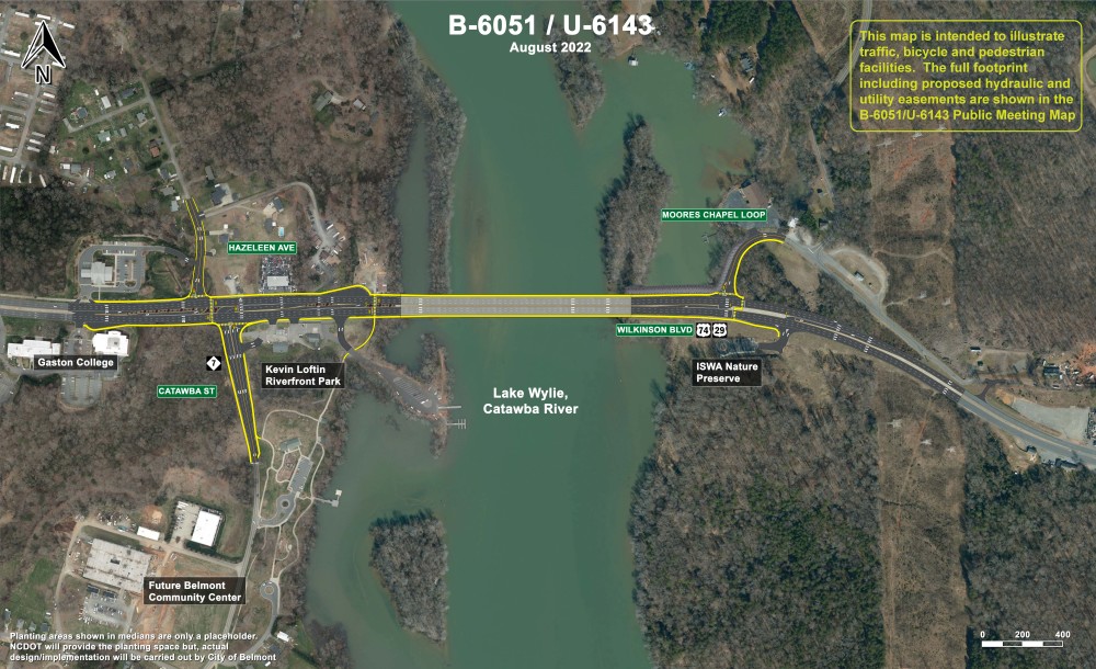
The project will include multiuse paths on both sides of Wilkinson Boulevard, connecting Gaston College with Kevin Loftin Riverfront Park and the ISWA Nature Preserve. Multi-use paths will also be included on both sides of Catawba Street, connecting Wilkinson Boulevard with the Kevin Loftin Park entrance on the east side of Catawba Street and to a greenway proposed by the City of Belmont on the west side.
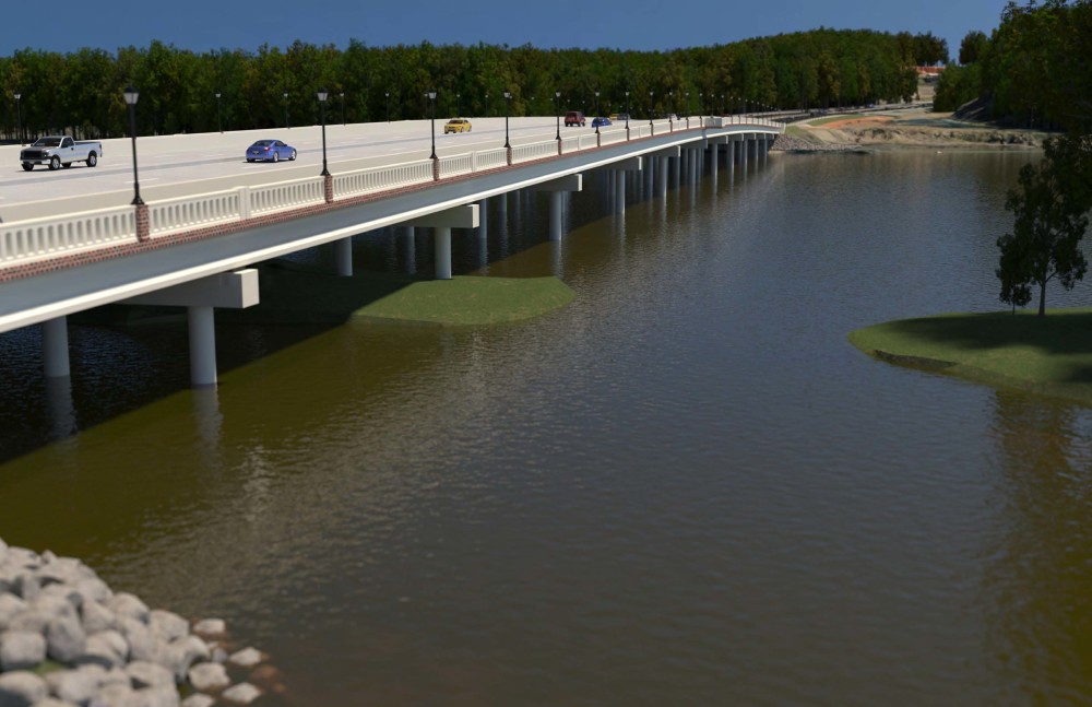
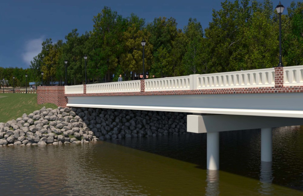
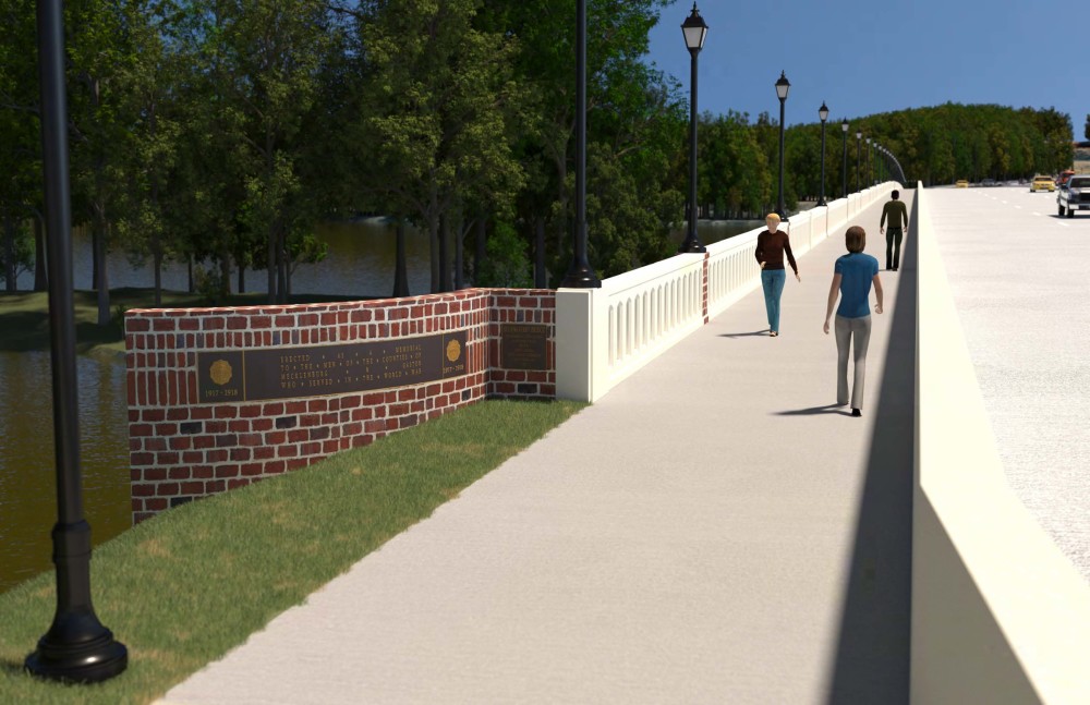
Proposed aesthetic treatments to the bridge include a decorative rail and substructure. The substructure will be stained beige and trimmed in a stamped brick pattern stained three colors. A pair of overlooks, accessible from the multi-use paths on either side, will be at the apex of the bridge. Light posts will also be included.
On the Belmont (Gaston County) side of the project, where there is sufficient space, the medians will be left open for the City to design and add landscaping after completion of the roadwork.
Project History
B-6051 was programmed in 2017 and planning began in 2018. In 2019, when it was realized that the footprint of B-6051 would be long enough to overlap with project U-6143,the projects were combined for planning, design and construction.
Public Involvement
Comments for this project were submitted by August 27, 2022.
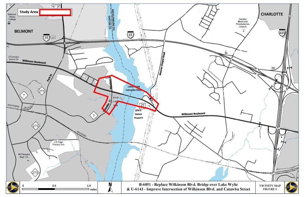
Project Map
View or download project map click here or on the map below
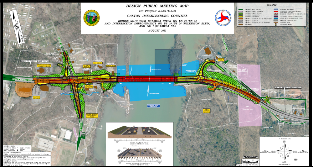
For additional information on how to read a public meeting map, click here.
Typical Sections
B-6051 Project Questions
What is a Reduced Conflict Intersection?
The most common type of reduced-conflict intersection design eliminates left turns from side roads onto busy main roads.
Raised medians direct traffic from the side road into turning right. When there is a safe opening in traffic, drivers enter the flow of traffic on the main route. To go the other direction (ltraditionally a eft turn), or cross the highway, they pull into a dedicated lane – typically less than 1,000 feet away – and make a U-turn. There may be a traffic signal at this location.
Watch this short video to get more information on Reduced Conflict Intersections:
U- 6143 project question
Bridge Visualizations

Project Funding:
Activity | Funded costs Costs* |
| Utility Relocation | $ 6,000,000 |
| Right-of-Way Acquisition | $ 4,000,000 |
Construction Cost | $ 52,000,000 |
| Total Cost | $56,600,000 |
*Estimated costs are subject to change.
Project Timeline:
Milestone | Date* |
Public Involvement | August 2022 |
| Environmental Document | November 2022 |
Right-of-Way Acquisition Begins | November 2022 |
Construction Begins | June 2024 |
* Future dates subject to change.
Project Comments
Comments for this project were submitted by August 27, 2022.
Project Contact
David Stutts
Project Manager
NCDOT Structures Management Unit
1581 Mail Service Center
Raleigh, NC 27699-1581
US74-29-Catawba-River@publicinput.com
984-205-6615 code 5269
Project Contact
John Williams
Consultant Project Manager
RK&K
8601 Six Forks Road Forum Suite 700
Raleigh, NC 27615
US74-29-Catawba-River@publicinput.com
984-205-6615 code 5269
Resources for Property Owners
Although the N.C. Department of Transportation works to minimize the number of homes and businesses displaced by a road project, it is inevitable, in many cases, that a certain amount of private property is needed. The following information explains right of way acquisition and answers questions about the process.
Right-of-Way Brochure Single Page Layout Folleto del Proceso de Adquisición de Bienes Raíces
Right-of-Way Frequently Asked Questions
Title VI Feedback
To ensure we’re hearing from a broad set of voices, would you be willing to share (completely anonymously) some information about yourself?
If so, please click here: https://publicinput.com/NCDOT-Title-VI